
 |
 |
 |
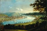
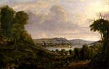
| An early painting by John Caspar Wild, c. 1835 |
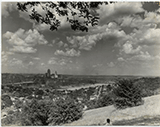
Early painting from what would become Devou Park |
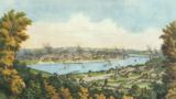
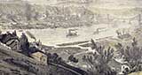
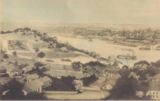
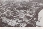
The Mouth of the Licking, 1846 |
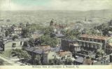
1837
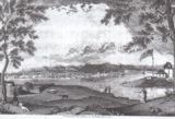
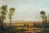
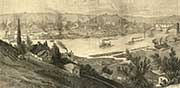
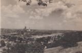
View of Cincinnati Ohio from Forest Hills, Kentucky by Thomas W. Whitley, c. 1840's
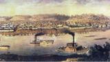
An 1853 painting by Edwin Beyer
 |
 |
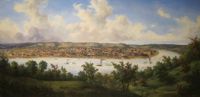
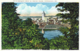
| View of Cincinnati from Covington, Kentucky c. 1851. Oil painting by Robert S. Duncanson. | View of Cincinnati, Ohio by J. W. Steel, from a daguerreotype in Graham's Magazine, 1848 |
Duncanson, a noted Afro-American painter, changed a few details from the earlier image: In the Steel image, there is a couple admiring the view; in the Duncanson, it's a pair of laborers; in the Steel, there's a white man with a rifle; while the Duncanson shows a black man with a scythe; there's a white woman hanging out wash in the Steel, but a black woman in the Duncanson. Read more about Duncanson at this site (Wikipedia) and this site (Taft Museum). |
|
 |
 |
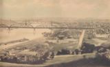
| Harpers Weekly Published this view of Cincinnati, with lots of detail of the Covington area, on June 24, 1876. It was drawn by Schell and Hogan, from a sketch by C. A. Vanderhoof. |
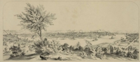
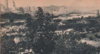
A painting from 1855. Notice the number and variations of the river traffic - steam boats, a steam ferry, at least two kinds of flatboats - and a large number of steamers on the Cincinnati side. |

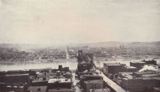
July 4, 1857
![]()
“Looking across the river, which at low water mark is, perhaps, a third of a mile wide, to the
Kentucky side, one sees, on the right bank of the Licking River, the city of Covington, a mass
of black factories and tall chimneys, from which smoke is always ascending, and spreading
out over the valley.” from Captain Willard Glazier's Peculiarities of American Cities, 1885.
![]()

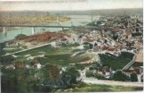
1872, note completed Suspension Bridge
1876
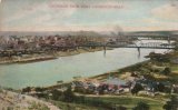
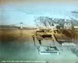
Covington Aerial, c. 1878
These are the far left and far right end, only, of a much larger engraving of the Cincinnati
river front in 1900 by infamous counterfeiter and engraver Charles Ulrich. Read more about it, at this site.
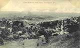
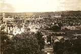
Peaselburg, c. 1900
From a Facebook post by Arlina Lag
 |
 |
 |
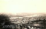
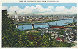
| Looking West | Covington and Newport, 1910 | from Cincinnati, 1930 |
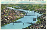
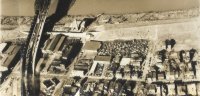
Bird's Eye Views of Covington, 1908
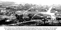
right, We know that the hill in the foreground was at one time a vineyard, and the
big red brick building below was a distillery.
 |
 |
 |
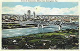
| Early Aerial of Covington | A 1914 Panorama from a Brian Schlosser Facebook post |
from "De Vou," c. 1910 |
 |
 |
|
| 1922. Orient yourself with St. Mary's at the top of the image | 1922. Orient yourself with the old Short Way (12th St) bridge at the bottom of the image |
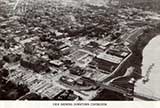
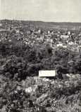
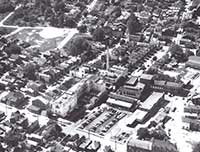
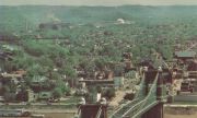
Aerial Views of Covington, c. 1930's
 |
 |
 |
 |
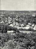
| from Devou Park | Bird's eye view of Covington, c. 1935 |
1930 | 1937, from a Magic Lantern slide from Facebook post by Robert Richshafer |
 |
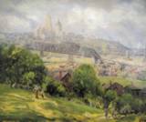 |
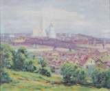
| Paintings from Devou | by Charles Meurer, 1932 |
 |
 |
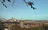
| Looking westerly | After I-75, but before the IRS Building From a Facebook post by Jim Steiner |
 |
 |
| St. Patrick's was on the east side of Philadelphia, between 4th and 5th. c. 1967. From a Facebook post by Chuck Eilerman | June, 1939. That's St. Aloysius on the right; John G. Carlisle toward the right. From a Facebook post by Judy Marqua Huth |
 |
 |
 |
 |
| Various aerial views, c. WWII | |||
 |
 |
|
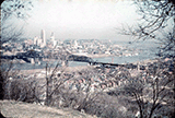
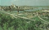
| Looking south, from the Suspension Bridge, c. 1940 |
c. 1940's |
 |
 |
 |
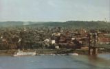
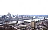
| 1953 | Real color Aerial from 1954 Thanks to Dr. Richard Cardosi for this one |
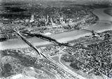
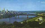
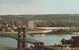
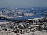
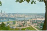
Covington Riverfront, 1959 |
 |
 |
|
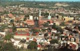
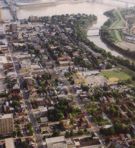
Downtown Covington, c. 1959 |
The C&O Bridge, Along the Ohio River, January, 1956 |
Aerial from 1959 |
Before I-75
From a Facebook post by Dr. Richard Cardosi
 |
 |
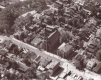
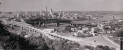
| Covington Aerials, c. 1960's | |
A twin pair of views, north and south, 1960
Dixie Highway in the extreme lower right
 |
 |
||
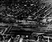
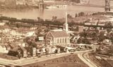
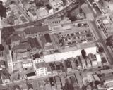
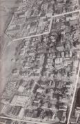
| While these are photos taken for Bavarian, note that the plant is barely visible in the lower right. Also, understand that literally every building in these middle two images no longer stands. | Bavarian Plant #1 is seen at the bottom, and Pike Street is seen at the top.
|
 |
 |
||
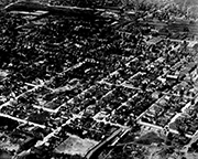
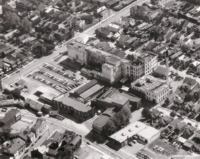
Bavarian Brewery and the neighborhood. That's South Main Street running left to upper right; Dixie Highway at the bottom.
|
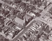
That's St. Patrick's Church and School. The church faced Philadelphia Street; the school's on the s.w. corner of 4th & Philadelphia. Bavarian's property is just barely in the shot at the far right. |
 |
 |
|
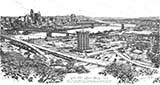
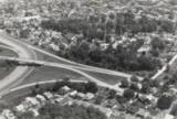
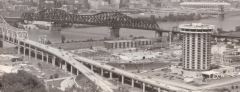
| Covington Aerial (the white lines show the proposed IRS Center) |
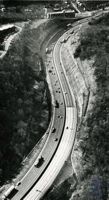
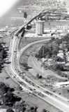
I-75 Construction -
looking south Note Jefferson Avenue exit |
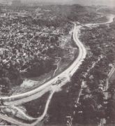
Aerial of The Cut, before it was straightened.
From a Facebook post by John Snyder
Short aerial video Covington
1967
From a Facebook post by
Kurt Hultquist
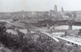
Aerial View of Covington, 1968
 |
 |
 |
 |
| c. 1980's | 1973 | c. 1960 From a Facebook post by Donald-Diann Rogers |
c. 1960 |
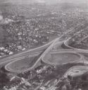
Aerial view of Spence Bridge, 1970.
A Jack Klumpe photo
 |
 |
The defunct Jefferson Street Exit on I-75
The bottom of the I-75 hill was rebuilt. It had acquired a nickname: Death Hill

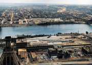
Covington Aerials which are likely older than you think!
1979
From a Facebook post by
Winston Beech
 |
 |
 |
| Looking south, from the Suspension Bridge, c. 1970 |
Newer Aerials | |
 |
 |
 |
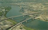
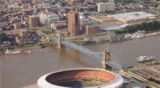
| Covington Aerial | Brent Spence Construction | Covington Riverfront Aerial |
Inside the Drawbridge Inn
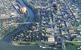
Relatively newer aerial views
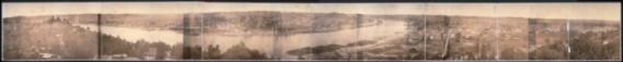
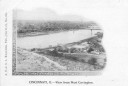
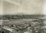
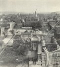
A photo of Cincinnati and Covington, circa 1866
![]()
Actually Cincinnati, but a mate of sorts to the above image.
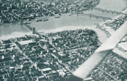
This one's from a daguerreotype from 1848, taken from Newport
That's the Public Landing on the far left. This is two miles of riverfront.
The detail on the original is such that it would take a 140,000 megapixel camera to replicate it.
![]()